
To the untrained eye, massive concrete dams, towering suspension bridges, high-rise skyscrapers, and valley slopes appear completely static and immovable. In reality, every physical structure and geological landform is in a state of continuous, microscopic motion. Changes in temperature, fluctuations in hydrostatic pressure, seismic activity, foundation settling, and tectonic plate shifts cause structures to expand, contract, tilt, warp, and slide. Deformation monitoring surveying—encompassing both structural health monitoring and geomorphological tracking—is the high-precision specialized discipline dedicated to measuring subtle horizontal and vertical movements over time to ensure public safety, prevent catastrophic structural failures, and validate engineering design assumptions.
The Fundamental Objectives of Deformation Monitoring
Unlike standard boundary or topographic surveys that capture a static snapshot of a site at a single moment in time, deformation monitoring is inherently multi-temporal. Its primary objective is to detect, quantify, and model spatial changes by comparing repeated measurements taken at precise intervals over months or years.
Deformation monitoring serves two distinct operational arenas:
- Structural Health Monitoring (SHM): Protecting engineered infrastructure—such as dams, bridges, tunnels, retaining walls, and tall buildings—from structural fatigue, foundation settlement, or unexpected load-bearing failures during and after construction.
- Geomorphological and Natural Hazard Monitoring: Tracking natural terrain dynamics—such as active landslides, unstable rock slopes, glacial retreat, sinkhole formation, and land subsidence caused by groundwater extraction or underground mining—to provide early warnings to vulnerable communities.
High-Precision Instrumentation and Sensor Ecosystems
Achieving millimeter-level or sub-millimeter-level precision requires deploying specialized, high-accuracy instruments combined into integrated sensor networks:
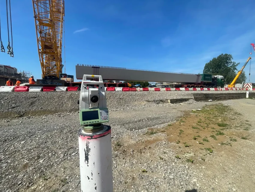
- Automated Motorized Total Stations (AMTS): For active construction sites, bridges, or unstable rock faces, robotic total stations are permanently installed in weather-proof shelters to execute automated monitoring cycles 24 hours a day. Sighting onto precision glass prisms affixed to critical structural nodes, AMTS units measure horizontal angles, vertical angles, and slope distances automatically, computing 3D coordinate displacements in real time.
- High-Precision GNSS Networks: Continuously Operating Reference Station (CORS) networks and dedicated arrays of geodetic GNSS receivers mounted on bridge pylons or dam crests track satellite carrier phases continuously. While GNSS is traditionally less precise vertically than horizontally, modern processing algorithms resolve vertical movements down to a few millimeters over long observation windows.
- Interferometric Synthetic Aperture Radar (InSAR): For regional-scale ground subsidence, volcanic uplift, or tectonic fault monitoring, satellite-based InSAR compares phase differences between radar images captured over the same area at different times. By analyzing radar wave interference patterns, geophysicists produce high-resolution displacement maps covering hundreds of square kilometers with millimeter precision.
- Geotechnical and Structural Sensors: Surveyors frequently integrate optical and satellite data with down-hole inclinometers (measuring subsurface shear movement), tiltmeters (detecting structural lean), extensometers (measuring crack opening widths), and piezometers (monitoring groundwater pore pressure).
Establishing Reference Networks: Stability is Paramount
The greatest challenge in deformation monitoring is establishing an absolute spatial reference frame. If the control monuments used as a baseline are themselves shifting due to regional soil settlement or tectonic movement, all measured deformation data becomes skewed.
Consequently, monitoring surveyors invest significant effort in establishing stable reference networks. Primary control points must be founded on deep bedrock well outside the zone of influence—often hundreds of meters away from the monitored structure or landslide. Rigorous redundancy, rigorous least-squares network adjustments, and independent checking methods are mandatory to separate true structural movement from instrument drift, thermal expansion of survey pillars, or local atmospheric refraction errors.
Real-World Applications Across Critical Sectors
- Dam Safety Monitoring: Large embankment and concrete gravity dams impound millions of gallons of water, exerting immense hydrostatic pressure. Surveyors monitor dam crest deflection, foundation seepage, and abutment stability under varying reservoir water levels to prevent catastrophic breaches.
- Urban Excavation and Tunneling: As heavy urban tunneling machines bore beneath dense city centers or deep excavation pits are dug for high-rise basements, surrounding buildings are at risk of settlement-induced cracking. Real-time monitoring systems track adjacent building tilt and street subsidence, halting construction instantly if movement exceeds safe thresholds.
- Landslide and Rockfall Mitigation: Along mountain highways and open-pit mines, automated radar and prism networks monitor unstable slopes prone to sudden failure, providing automated alarm triggers that close roadways or evacuate heavy equipment before a slide occurs.
Data Analysis, Modeling, and Early Warning Systems
Raw displacement numbers alone are insufficient without rigorous analysis. Monitoring engineers analyze displacement vectors over time, plotting time-series graphs of velocity and acceleration. If movement accelerates non-linearly—signifying impending structural yield or slope shear failure—automated alert protocols instantly dispatch warning SMS messages and emails to project engineers, emergency responders, and site managers, transforming precise geospatial data into life-saving early warnings.